| Bruntsfield Links | |
|---|---|
 | |
 | |
| Type | Public park and golf course |
| Location | Bruntsfield, Edinburgh, Scotland |
| Coordinates | 55°56′22″N 3°12′08″W / 55.9395°N 3.2023°W |
| Operated by | City of Edinburgh Council |
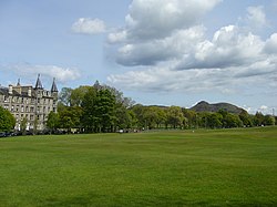
Bruntsfield Links is 35 acres (14 ha) of open parkland in Bruntsfield, Edinburgh, immediately to the south-west of the adjoining Meadows.
Unlike The Meadows, which formerly contained a loch drained by the end of the 18th century, Bruntsfield Links has always been dry ground. It is the last vestige of the Burgh Muir, former woodland which stretched southwards to the Jordan Burn at the foot of the slope now covered by the built-up areas of the Grange and Morningside. The woodland was cleared in accordance with a decree of James IV in 1508, much of the wood being used to build timber-fronted houses and forestairs in the Lawnmarket and West Bow area of the Old Town.[1]
- ^ J Grant, Old And New Edinburgh, Cassell, 1880, vol.III, p. 28