You can help expand this article with text translated from the corresponding article in Dutch. Click [show] for important translation instructions.
|
| Ring R0 | |
|---|---|
| Brussels Ring | |
 | |
| Route information | |
| Length | 76 km (47 mi) |
| Location | |
| Country | Belgium |
| Highway system | |
| |
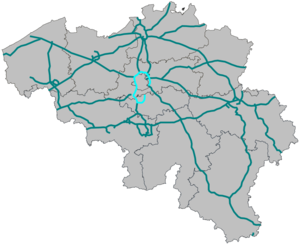
The Brussels Ring (Dutch: Brusselse Ring, French: Ring de Bruxelles), numbered R0, is a ring road surrounding the Brussels-Capital Region, as well as other smaller towns south of Brussels. It is about 75 kilometres (47 mi) long, with two or three lanes in each direction. While most of it is classified as a motorway (highway), part of it (in the Sonian Forest) is merely an express route. It crosses the three regions of Belgium: its main part (51.7 kilometres (32.1 mi)) is situated in Flanders, whereas Wallonia comprises 18.2 kilometres (11.3 mi) of the total stretch and 5.5 kilometres (3.4 mi) is on Brussels territory.
The clockwise carriageway is referred to as the inner ring (French: ring intérieur, Dutch: binnenring), while the anticlockwise carriageway is referred to as the outer ring (French: ring extérieur, Dutch: buitenring).
