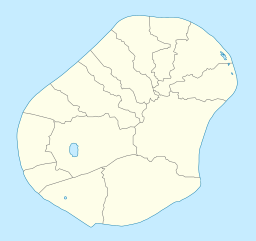
| Buada Lagoon | |
|---|---|
 Buada Lagoon | |
| Location | Nauru |
| Coordinates | 0°32′7″S 166°55′20″E / 0.53528°S 166.92222°E |
| Type | lake |
| Surface area | 3.8 ha (9.4 acres) |
| Max. depth | 5 m (16 ft) |
Buada Lagoon is a landlocked, slightly brackish, freshwater lake of Buada District in the island nation of Nauru. It occupies 3.8 ha (9.4 acres) with a depth of up to 2m after an extended rainfall. [1][2][3]
The lagoon is classified as an endorheic lake, meaning there is no outflow to other bodies of water such as oceans or rivers.
The Buada Lagoon is the biggest and only true lake in Nauru, a small nation in Oceania consisting of a flat island of 21.3 km2 (8.2 sq mi) in area. The lake lies in Nauru's Buada district, from which it gets its name. It is not a lagoon as such, in that the lake is not joined to the sea, but its water is slightly brackish.[4][5]
Freshwater is rare in Nauru, being present only in the form of a small phreatic zone, the Moqua Well (a small underground lake) and the Buada Lagoon, which is the most visible, rivers and streams being utterly absent from the country.[6][7]
The lake has traditionally been used for pisciculture, which saw the raising of milkfish for human consumption through the centuries, and even though this practice was given up in the 1960s, it has lately seen efforts to revive it, despite the lagoon's water pollution.
- ^ Alberti, Luca; La Licata, Ivana; Cantone, Martino (2017-10-13). "Saltwater Intrusion and Freshwater Storage in Sand Sediments along the Coastline: Hydrogeological Investigations and Groundwater Modeling of Nauru Island". Water. 9 (10): 788. doi:10.3390/w9100788. hdl:11311/1033832. ISSN 2073-4441.
- ^ Spennemann, Dirk H.R. (2002). "[No title found]". Aquaculture International. 10 (6): 551–562. doi:10.1023/A:1023900601000.
- ^ Fortes, Romeo D. (2005). "Review of techniques and practices in controlling tilapia populations and identification of methods that may have practical applications in Nauru including a national tilapia plan" (PDF). Secretariat of the Pacific Community. ISBN 982-00-0123-4. ISSN 1683-7568.
- ^ Cite error: The named reference
UNEPwas invoked but never defined (see the help page). - ^ Cite error: The named reference
Wetlands Internationalwas invoked but never defined (see the help page). - ^ Climate Change Response Under the United Nations Framework Convention on Climate Change.
- ^ Cite error: The named reference
UNCCDwas invoked but never defined (see the help page).
