Buchenbach | |
|---|---|
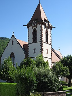
 Buchenbach parish church | |
Location of Buchenbach within Breisgau-Hochschwarzwald district  | |
| Coordinates: 47°57′39″N 08°00′34″E / 47.96083°N 8.00944°E | |
| Country | Germany |
| State | Baden-Württemberg |
| Admin. region | Freiburg |
| District | Breisgau-Hochschwarzwald |
| Subdivisions | 4 communities |
| Government | |
| • Mayor (2020–28) | Ralf Kaiser[1] |
| Area | |
| • Total | 38.99 km2 (15.05 sq mi) |
| Highest elevation | 1,156 m (3,793 ft) |
| Lowest elevation | 420 m (1,380 ft) |
| Population (2022-12-31)[2] | |
| • Total | 3,114 |
| • Density | 80/km2 (210/sq mi) |
| Time zone | UTC+01:00 (CET) |
| • Summer (DST) | UTC+02:00 (CEST) |
| Postal codes | 79256 |
| Dialling codes | 07661 |
| Vehicle registration | FR |
| Website | www.buchenbach.de |
Buchenbach is a municipality in the south west of the Black Forest in Germany. It is located in the district of Breisgau-Hochschwarzwald in Baden-Württemberg. It is made up of four communities, the main town of Buchenbach and the villages of Falkensteig, Unteribental and Wagensteig. The current municipality was formed by the merger of the former entities of Buchenbach and Falkensteig on 1 December 1971, with Wagensteig being joined to them on 1 August 1973 and Unteribental on 1 January 1975.
- ^ Aktuelle Wahlergebnisse, Staatsanzeiger, accessed 11 September 2021.
- ^ "Bevölkerung nach Nationalität und Geschlecht am 31. Dezember 2022" [Population by nationality and sex as of December 31, 2022] (CSV) (in German). Statistisches Landesamt Baden-Württemberg. June 2023.


