Bucksport, South Carolina | |
|---|---|
 Along the Intracoastal Waterway at Bucksport | |
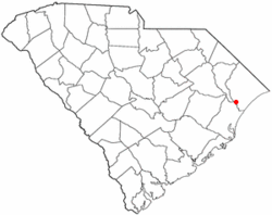
 Location in South Carolina | |
| Coordinates: 33°40′2″N 79°6′18″W / 33.66722°N 79.10500°W | |
| Country | United States |
| State | South Carolina |
| County | Horry |
| Area | |
| • Total | 4.22 sq mi (10.94 km2) |
| • Land | 4.20 sq mi (10.89 km2) |
| • Water | 0.02 sq mi (0.05 km2) |
| Elevation | 20 ft (6 m) |
| Population | |
| • Total | 745 |
| • Density | 177.21/sq mi (68.42/km2) |
| Time zone | UTC-5 (EST) |
| • Summer (DST) | UTC-4 (EDT) |
| ZIP code | 29527 |
| Area code(s) | 843, 854 |
| FIPS code | 45-10000[3] |
| GNIS feature ID | 1231099[4] |
Bucksport is an unincorporated community and census-designated place (CDP) in Horry County, South Carolina, United States. The population was 876 at the 2010 census.[5] It is a rural port on the Atlantic Intracoastal Waterway at the merger point with the Waccamaw River. The port has some services available for boaters and is also home to the Bucksport Restaurant.
- ^ "ArcGIS REST Services Directory". United States Census Bureau. Retrieved October 15, 2022.
- ^ "Census Population API". United States Census Bureau. Retrieved October 15, 2022.
- ^ "U.S. Census website". United States Census Bureau. Retrieved January 31, 2008.
- ^ "US Board on Geographic Names". United States Geological Survey. October 25, 2007. Retrieved January 31, 2008.
- ^ "Geographic Identifiers: 2010 Census Summary File 1 (G001): Bucksport CDP, South Carolina". American Factfinder. U.S. Census Bureau. Archived from the original on February 13, 2020. Retrieved January 26, 2018.