Hadiya Budhabare
हडिया बुधवारे | |
|---|---|
Village of Buddhashanti Rural Municipality | |
 Bird's eye view of part of Budhabare | |
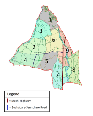
 Map of Budhabare depicting its constituent wards | |
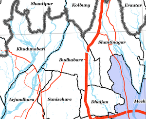
 Zoomed-in map of Jhapa district showing Budhabare and its adjacent areas | |
| Coordinates: 26°43′26″N 88°03′01″E / 26.723838°N 88.050179°E | |
| Country | |
| Province | Province No. 1 |
| District | Jhapa |
| Area | |
| • Total | 31.73 km2 (12.25 sq mi) |
| Highest elevation | 329 m (1,079 ft) |
| Lowest elevation | 149 m (489 ft) |
| Population (2011) | |
| • Total | 22,936 |
| • Density | 722.85/km2 (1,872.2/sq mi) |
| • Ethnicities | Brahmin Chhetri Kami Limbu Rai |
| Demonym | Budhabarebasi |
| Time zone | UTC+5:45 (NST) |
| A.P.O. | 57206 |
| PSTN | 555 |
Budhabare, more specifically Hadiya Budhabare[citation needed], is a village and former Village Development Committee that is now part of Buddhashanti Rural Municipality in Jhapa district of Province No. 1 in south-eastern Nepal. The latest official data, 2011 Nepal Census, puts the total population of the VDC at 22,936.[1] Owing to this average population size, the VDC has been divided into nine wards.
As the village is crossed by Hadiya Khola, it is sometimes also referred to as Hadiya Budhabare. The village of Budhabare is best known for two things: the production of betelnut and the market that is held every Wednesday. The market of Budhabare grew in importance tremendously after the highway to Ilam was constructed, as Budhabare now lies along the Mechi Highway, which connects all the districts of Mechi zone.[citation needed]
