| Budj Bim | |
|---|---|
| Mount Eccles | |
| Highest point | |
| Elevation | 178 m (584 ft) |
| Coordinates | 38°3′46″S 141°55′32″E / 38.06278°S 141.92556°E |
| Geography | |
| Location | Victoria, Australia |
| Climbing | |
| Easiest route | Lava Canal track |
| Official name | Budj Bim National Heritage Landscape |
| Designated | 20 July 2004 |
| Official name | Budj Bim Cultural Landscape |
| Type | Cultural |
| Criteria | iii, v |
| Designated | 6 July 2019 (43rd session) |
| Reference no. | 1577 |
| Region | Asia-Pacific |
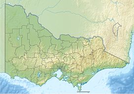
Budj Bim, also known as Mount Eccles, is a dormant volcano near Macarthur in southwestern Victoria, Australia. It lies within the geologically-defined area known as the Newer Volcanics Province, which is the youngest volcanic area in Australia and stretches from western Victoria to south-eastern South Australia.
It is situated within the Budj Bim National Park. Budj Bim is the Gunditjmara name, meaning "High Head". The roughly conical peak rises 178 metres (584 ft) above surrounding area. The peak is a scoria hill that was thrown up beside a group of three overlapping volcanic craters that now contain Lake Surprise. A line of smaller craters and scoria cones runs to the southeast. Lava flows extend to form a shield volcano and are fed by several lava channels, or "lava canals" as they are known locally. This lava flow, known as the Tyrendarra lava flow, changed the drainage pattern of the region, and created large wetlands.
Large areas to the west and south-west of the mountain have been heritage-listed. The Budj Bim heritage areas include the Tyrendarra Indigenous Protected Area (designated in December 2003), the Budj Bim National Heritage Landscape (added to the National Heritage List in July 2004), and the Budj Bim Cultural Landscape (designated a UNESCO World Heritage Site in July 2019).
