City of Buena Vista | |
|---|---|
 | |
 | |
| Coordinates: 37°44′04″N 79°21′15″W / 37.73444°N 79.35417°W | |
| Country | United States |
| State | Virginia |
| County | None (Independent city) |
| Hart's Bottom Green Forest Green Valley | c. 1800 |
| Buena Vista | December 1888 |
| Incorporated (town) | 1890 |
| Incorporated (independent city) | 15 February 1892 |
| Area | |
• Total | 6.52 sq mi (16.89 km2) |
| • Land | 6.44 sq mi (16.67 km2) |
| • Water | 0.09 sq mi (0.22 km2) |
| Elevation | 837 ft (255 m) |
| Population (2020) | |
• Total | 6,641 |
| • Density | 1,000/sq mi (390/km2) |
| Time zone | UTC−5 (Eastern (EST)) |
| • Summer (DST) | UTC−4 (EDT) |
| Zip code | 24416 |
| FIPS code | 51-11032[2] |
| GNIS feature ID | 1492666[3] |
| Website | https://www.buenavistava.org/ |

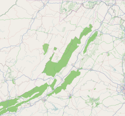
Buena Vista (/ˌbjuːnəˈvɪstə/ BEW-nə-VIS-tə) is an independent city located in the Blue Ridge Mountains region of Virginia in the United States. As of the 2020 census, the population was 6,641.[4] The Bureau of Economic Analysis combines the independent cities of Buena Vista and Lexington, along with surrounding Rockbridge County, for statistical purposes.
The city is located approximately 39 miles northwest of Lynchburg and 56 miles northeast of Roanoke.[5][6]
- ^ "2019 U.S. Gazetteer Files". United States Census Bureau. Retrieved August 7, 2020.
- ^ "U.S. Census website". United States Census Bureau. Retrieved January 31, 2008.
- ^ "US Board on Geographic Names". United States Geological Survey. October 25, 2007. Retrieved January 31, 2008.
- ^ "State & County QuickFacts". United States Census Bureau. Archived from the original on March 10, 2014. Retrieved January 5, 2014.
- ^ "Distance between Buena Vista, VA and Lynchburg, VA". www.distance-cities.com. Retrieved September 20, 2022.
- ^ "Distance between Buena Vista, VA and Roanoke, VA". www.distance-cities.com. Retrieved September 20, 2022.


