This article includes a list of general references, but it lacks sufficient corresponding inline citations. (August 2019) |
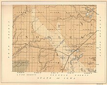
Buffalo Ridge is a large expanse of rolling hills in the southeastern part of the larger Coteau des Prairies. It stands 1,995 feet (608 m) above sea level. The Buffalo Ridge is sixty miles (97 km) long and runs through Lincoln, Pipestone, Murray, Nobles, and Rock counties in the southwest corner of Minnesota, and Minnehaha, Moody, and Lincoln counties in southeast South Dakota.
Because of its altitude and high average wind speed, Buffalo Ridge has been transformed into a place for creating renewable energy. As of May 2022, over 1,000 wind turbines stand in the Buffalo Ridge area.[1]


- ^ "County Energy Production". www.mndor.state.mn.us. Retrieved March 23, 2024.
- ^ "Nobles Map". Wgtn.net. Archived from the original on July 24, 2011.