Bukit Merah | |
|---|---|
| Other transcription(s) | |
| • English | Redhill |
| • Chinese | 红山 Hóngshān (Pinyin) Âng-soaⁿ (Hokkien POJ) |
| • Malay | Bukit Merah بوكيت ميره |
| • Tamil | புக்கிட் மேரா |
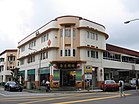
From top left to right: HarbourFront, Singapore Improvement Trust flats in Tiong Bahru, Skyline of Redhill, Henderson Waves, Jetty at Labrador Nature Reserve | |
 Location in Central Region | |
| Coordinates: 1°16′54.86″N 103°49′26.11″E / 1.2819056°N 103.8239194°E | |
| Country | |
| Region | Central Region
|
| CDCs | |
| Town councils |
|
| Constituencies | |
| Government | |
| • Mayors | Central Singapore CDC
South West CDC |
| • Members of Parliament | Jalan Besar GRC
Radin Mas SMC Tanjong Pagar GRC West Coast GRC |
| Area | |
• Total | 14.34 km2 (5.54 sq mi) |
| • Residential | 3.12 km2 (1.20 sq mi) |
| Population | |
• Total | 151,250 |
| • Density | 11,000/km2 (27,000/sq mi) |
| Ethnic groups | |
| • Chinese | 120,830 |
| • Malays | 11,430 |
| • Indians | 13,980 |
| • Others | 5,010 |
| Postal districts | 2, 3, 4, 5, 9, 10 |
| Dwelling units | 51,885 |
| Projected ultimate | 68,000 |
Bukit Merah, also known as Redhill, is a planning area and new town situated in the southernmost part of the Central Region of Singapore. The planning area borders Tanglin to the north, Queenstown to the west and the Downtown Core, Outram and Singapore River planning areas of the Central Area to the east. It also shares a maritime boundary with the Southern Islands planning area to the south. Bukit Merah is linked to Sentosa Island via Sentosa Gateway, Sentosa Broadwalk, Sentosa Express and the Cable Car.
Bukit Merah planning area also includes two offshore islands which are linked to the mainland by road, namely Pulau Brani and Keppel Island. It is the most populated planning area in the Central Region, and the 12th most populated planning area in the country overall, being home to more than 150,000 residents.[5]
- ^ a b City Population – statistics, maps and charts | Bukit Merah
- ^ a b HDB Key Statistics FY 2014/2015 Archived 4 March 2016 at the Wayback Machine
- ^ "Statistics Singapore - Geographic Distribution - 2018 Latest Data". Retrieved 11 February 2019.
- ^ "Singapore Residents by Planning Area/Subzone, 2015". Singapore Department of Statistics. Archived from the original (XLS) on 10 June 2016. Retrieved 24 May 2016.
- ^ "Statistics Singapore – Geographic Distribution". singstat.gov.sg. Archived from the original on 16 November 2016. Retrieved 6 June 2017.


