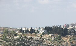
Burham | |
|---|---|
| Arabic transcription(s) | |
| • Arabic | بُرهام |
| • Latin | Boorhem (official) Kh. Miriam[1] (unofficial) |
 Burham mosque | |
Location of Burham within Palestine | |
| Coordinates: 31°59′21″N 35°10′29″E / 31.98917°N 35.17472°E | |
| Palestine grid | 166/155 |
| State | State of Palestine |
| Governorate | Ramallah and al-Bireh |
| Government | |
| • Type | Local Development Committee |
| Area | |
| • Total | 1,589 dunams (1.6 km2 or 0.6 sq mi) |
| Population (2017)[2] | |
| • Total | 583 |
| • Density | 360/km2 (940/sq mi) |
| Name meaning | Khurbet Burheim; The ruin of Burheim, from personal name[3] |
Burham (Arabic: بُرهام) is a Palestinian village in the Ramallah and al-Bireh Governorate located twelve kilometers north of Ramallah. The largest nearby town is Bir Zeit located to the southeast. The average elevation of Burham is 680 meters above sea level.[4] The village was established during the Byzantine Empire rule over Palestine.[5]
- ^ Cite error: The named reference
SWP330was invoked but never defined (see the help page). - ^ Preliminary Results of the Population, Housing and Establishments Census, 2017 (PDF). Palestinian Central Bureau of Statistics (PCBS) (Report). State of Palestine. February 2018. pp. 64–82. Retrieved 2023-10-24.
- ^ Palmer, 1881, p. 233
- ^ Welcome to Burham
- ^ Taha, Hamdan, 2002: The Sanctuary of Sheikh al-Qatrawani, Studium Biblicum Franciscanum - Jerusalem
