| Burke Brook | |
|---|---|
 | |
| Location | |
| Country | Canada |
| State | Ontario |
| Region | Greater Toronto Area |
| City | Toronto |
| Physical characteristics | |
| Source | |
| • location | Glenview Senior Public School, Canada |
| • coordinates | 43°43′14″N 79°24′29″W / 43.720583°N 79.408013°W |
| • elevation | 178 m (584 ft) |
| Mouth | Don River |
• location | Sunnybrook Park, Canada |
• coordinates | 43°43′14″N 79°21′56″W / 43.720586°N 79.365653°W |
• elevation | 134 m (440 ft) |
| Length | 9 km (5.6 mi) |
| Basin features | |
| River system | Don River |
| Tributaries | |
| • left | North Toronto Storm Trunk Sewer |
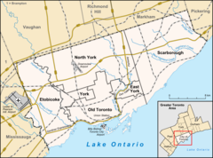
Burke Brook is a small stream in Toronto, Ontario. It is part of the Don River watershield, a major river that flows into Lake Ontario. The north end of the stream begins near Glenview Senior Public School.[1]
- ^ "Google Maps". Google Maps. Retrieved 2017-03-06.
