Burns, Oregon | |
|---|---|
 North Broadway Avenue (2008) | |
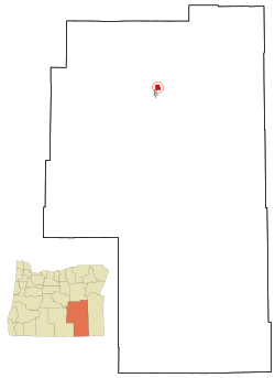
 Location within Harney County and Oregon | |
| Coordinates: 43°35′13″N 119°3′36″W / 43.58694°N 119.06000°W | |
| Country | United States |
| State | Oregon |
| County | Harney |
| Incorporated | 1891 |
| Government | |
| • Mayor | Jerry Woodfin[1] |
| • Sheriff | Dan Jenkins |
| Area | |
• Total | 3.55 sq mi (9.20 km2) |
| • Land | 3.55 sq mi (9.20 km2) |
| • Water | 0.00 sq mi (0.00 km2) |
| Elevation | 4,147 ft (1,264 m) |
| Population | |
• Total | 2,730 |
| • Density | 769.01/sq mi (296.90/km2) |
| U.S. Census | |
| Time zone | UTC-8 (Pacific) |
| • Summer (DST) | UTC-7 (Pacific) |
| ZIP code | 97720 |
| Area code | 541 |
| FIPS code | 41-09800 [4] |
| GNIS feature ID | 1118337 [5] |
| Website | City of Burns Oregon |
Burns is a city in and the county seat of Harney County, in the U.S. state of Oregon. According to the 2020 census, the population was 2,730. Burns and the nearby city of Hines are home to about 60 percent of the people in the sparsely populated county, by area the largest in Oregon and the ninth largest in the United States.
The Burns–Hines region has a high-desert climate but was much wetter in the recent geologic past. The Harney Basin was the largest of many depressions in which lakes formed in southeastern Oregon during the late Pleistocene. Remnants of an ancient lake that reached as far north as Burns are at the center of the Malheur National Wildlife Refuge, south of the city.
Northern Paiutes or their ancestors, who were hunter-gatherers, have lived in the region for thousands of years. Since the arrival of Euro-Americans in the 19th century, cattle ranching and other forms of agriculture have dominated land use in the area. In 1930, logging in the mountains north of Burns led to the creation of Hines, a lumber company town, and the timber industry remained important to the local economy until the 1990s. In addition to ranching, a variety of private and public enterprises support the Burns–Hines economy in the 21st century. Annual events include a migratory bird festival, the county fair, and a country music jamboree.
- ^ Cite error: The named reference
mayorwas invoked but never defined (see the help page). - ^ "ArcGIS REST Services Directory". United States Census Bureau. Retrieved October 12, 2022.
- ^ Cite error: The named reference
USCensusDecennial2020CenPopScriptOnlywas invoked but never defined (see the help page). - ^ "Geographic Identifiers: Burns City, Oregon". American FactFinder. U.S. Census Bureau. Archived from the original on February 12, 2020. Retrieved April 8, 2013.
- ^ "Burns". Geographic Names Information System. United States Geological Survey. November 28, 1980. Retrieved April 8, 2013.