Burns, Wyoming | |
|---|---|
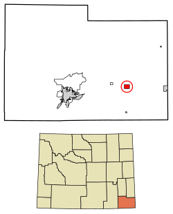
 Location of Burns in Laramie County, Wyoming. | |
| Coordinates: 41°11′31″N 104°21′29″W / 41.19194°N 104.35806°W | |
| Country | United States |
| State | Wyoming |
| County | Laramie |
| Government | |
| • Type | Mayor and Council |
| • Mayor | James "Okie" Clark |
| Area | |
| • Total | 3.05 sq mi (7.91 km2) |
| • Land | 3.05 sq mi (7.91 km2) |
| • Water | 0.00 sq mi (0.00 km2) |
| Elevation | 5,518 ft (1,682 m) |
| Population | |
| • Total | 356 |
| • Density | 118.27/sq mi (45.01/km2) |
| Time zone | UTC-7 (Mountain (MST)) |
| • Summer (DST) | UTC-6 (MDT) |
| ZIP code | 82053 |
| Area code | 307 |
| FIPS code | 56-11265[3] |
| GNIS feature ID | 1609075[4] |
| Website | www.burnswy.com |
Burns is a town in Laramie County, Wyoming, United States. It is part of the Cheyenne, Wyoming Metropolitan Statistical Area. The population was 301 at the 2010 census.[6]
- ^ "2019 U.S. Gazetteer Files". United States Census Bureau. Retrieved August 7, 2020.
- ^ Cite error: The named reference
wwwcensusgovwas invoked but never defined (see the help page). - ^ "U.S. Census website". United States Census Bureau. Retrieved January 31, 2008.
- ^ "US Board on Geographic Names". United States Geological Survey. October 25, 2007. Retrieved January 31, 2008.
- ^ "Population and Housing Unit Estimates". United States Census Bureau. May 24, 2020. Retrieved May 27, 2020.
- ^ "Profile of General Population and Housing Characteristics: 2010 Demographic Profile Data (DP-1): Burns town, Wyoming". United States Census Bureau. Retrieved April 2, 2012.
