This article contains promotional content. (November 2018) |
Burnsville | |
|---|---|
 Grande Market Square at Nicollet Avenue and Burnsville Parkway is the cornerstone of the Heart of the City project. | |
| Nickname: South of the River | |
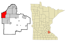
 Location of the city of Burnsville within Dakota County, Minnesota | |
| Coordinates: 44°46′04″N 93°16′39″W / 44.76778°N 93.27750°W | |
| Country | United States |
| State | Minnesota |
| County | Dakota |
| Founded | 1855 |
| Established | 1858 |
| Incorporated | 1964 |
| Government | |
| • Type | Mayor-council government – Executive form |
| • Mayor | Elizabeth Kautz |
| • City Manager | Gregg Lindberg |
| Area | |
• City | 26.98 sq mi (69.89 km2) |
| • Land | 24.94 sq mi (64.59 km2) |
| • Water | 2.05 sq mi (5.30 km2) |
| Elevation | 971 ft (297 m) |
| Population | |
• City | 64,317 |
• Estimate (2022)[3] | 63,936 |
| • Rank | US: 603rd MN: 14th |
| • Density | 2,579.18/sq mi (995.82/km2) |
| • Metro | 3,693,729 (US: 16th) |
| Time zone | UTC−6 (Central (CST)) |
| • Summer (DST) | UTC−5 (CDT) |
| ZIP Codes | 55306, 55337 |
| Area code | 952 |
| FIPS code | 27-08794 |
| GNIS feature ID | 0640669[4] |
| Website | burnsvillemn.gov |
Burnsville (/ˈbɜːrnzvɪl/ BURNZ-vil) is a city 15 miles (24 km) south of downtown Minneapolis in Dakota County, Minnesota. The city is situated on a bluff overlooking the south bank of the Minnesota River, upstream from its confluence with the Mississippi River. Burnsville and nearby suburbs form the southern portion of Minneapolis–Saint Paul, the 16th-largest metropolitan area in the United States, with about 3.7 million residents. At the 2020 census the population was 64,317.[2]
The name Burnsville is attributed to an early Irish settler and land owner, William Byrne. His surname was recorded as "Burns" and was never corrected.[5]
Burnsville stands on land that once contained a village of Mdewakanton Dakota. Later, it became a rural Irish farming community. Burnsville became Minnesota's 14th-largest city in the 2020 census following the construction of Interstate 35. Now the ninth-largest suburb in the metro area and a bedroom community of both Minneapolis and Saint Paul, it was fully built by the late 2000s. Burnsville's downtown area is called Heart of the City with urban-style retail and condominiums.[6] The Burnsville Transit Station serves as the hub and headquarters of the Minnesota Valley Transit Authority, providing regional bus service to five other suburbs.
Burnsville is home to a regional mall (Burnsville Center), a section of Murphy-Hanrehan Park Reserve, 310-foot (94 m) vertical ski peak Buck Hill, and part of the Minnesota Valley National Wildlife Refuge.
- ^ "2020 U.S. Gazetteer Files". United States Census Bureau. Retrieved July 24, 2022.
- ^ a b "Explore Census Data". United States Census Bureau. Retrieved November 24, 2023.
- ^ Cite error: The named reference
USCensusEst2022was invoked but never defined (see the help page). - ^ "US Board on Geographic Names". United States Geological Survey. October 25, 2007. Retrieved January 31, 2008.
- ^ "Burnsville 76; A Community History". Burnsville Heritage Committee. 1976. Archived from the original on July 31, 2009. Retrieved September 8, 2007.
- ^ Maler, Kevin (April 30, 2006). "Suburbs Want Downtowns of Their Own". The New York Times.
