| Burraneer Sydney, New South Wales | |||||||||||||||
|---|---|---|---|---|---|---|---|---|---|---|---|---|---|---|---|
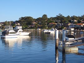
 Gunnamatta Bay, Burraneer | |||||||||||||||
 | |||||||||||||||
| Coordinates | 34°04′12″S 151°08′12″E / 34.06996°S 151.13664°E | ||||||||||||||
| Population | 3,719 (2021 census)[1] | ||||||||||||||
| Postcode(s) | 2230 | ||||||||||||||
| Elevation | 21 m (69 ft) | ||||||||||||||
| Location | 26 km (16 mi) south of Sydney CBD | ||||||||||||||
| LGA(s) | Sutherland Shire | ||||||||||||||
| State electorate(s) | Cronulla | ||||||||||||||
| Federal division(s) | Cook | ||||||||||||||
| |||||||||||||||
Burraneer is a bayside suburb in southern Sydney, in the state of New South Wales, Australia. Burraneer is 26 kilometres south of the Sydney central business district, in the local government area of the Sutherland Shire.
Burraneer sits on the peninsula of Burraneer Point, on the north shore of the Port Hacking estuary. Burraneer Bay forms the western border and Gunnamatta Bay the eastern border. Woolooware is the only adjacent suburb. Cronulla is located across Gunnamatta Bay. The suburbs of Dolans Bay, Port Hacking and Caringbah South are located across Burraneer Bay. The villages of Maianbar and Bundeena are located on the opposite bank of Port Hacking. Burraneer is a mostly residential suburb comprising predominantly large family homes with some offering expansive water views of the Port Hacking.
- ^ Australian Bureau of Statistics (28 June 2022). "Burraneer (State Suburb)". 2021 Census QuickStats. Retrieved 6 August 2024.
