| Burrinjuck Dam | |
|---|---|
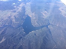
 Aerial view of Burrinjuck Dam, 2017 | |
Location of the Burrinjuck Dam in New South Wales | |
| Country | Australia |
| Location | Burrinjuck, South West Slopes, New South Wales |
| Coordinates | 34°59′54″S 148°35′04″E / 34.99833°S 148.58444°E |
| Status | Operational |
| Construction began | 1907[1] |
| Opening date | 1928 |
| Owner(s) | WaterNSW |
| Dam and spillways | |
| Type of dam | Gravity dam |
| Impounds | Murrumbidgee River |
| Height | 93 m (305 ft) |
| Length | 233 m (764 ft) |
| Dam volume | 394,000 m3 (13,900,000 cu ft) |
| Spillways | 3 |
| Spillway type | Three sector gates with two side channel spillways |
| Spillway capacity | 29,100 m3/s (1,030,000 cu ft/s) |
| Reservoir | |
| Creates | Lake Burrinjuck |
| Total capacity | 1,026 gigalitres (3.62×10¹⁰ cu ft) |
| Catchment area | 12,953 km2 (5,001 sq mi) |
| Surface area | 5,500 ha (14,000 acres) |
| Maximum water depth | 72 m (236 ft) |
| Power Station | |
| Operator(s) | Foresight Group |
| Commission date | 1928 |
| Turbines | 3 (2x6, 1x16) |
| Installed capacity | 28 MW |
| Annual generation | 24.5 gigawatt-hours (88 TJ) |
| Website Burrinjuck Dam at WaterNSW | |
Burrinjuck Dam is a gated, concrete-walled hydro-electric gravity dam at Burrinjuck, in the South West Slopes region of New South Wales, Australia. It has three spillways across the Murrumbidgee River and forms an impounded reservoir called Lake Burrinjuck. In addition to electricity generation, Burrinjuck Dam is used for purposes including flood mitigation, irrigation, water supply and conservation. Also known as Barren Jack Dam and Barrenjack, it was added to the New South Wales State Heritage Register on 2 April 1999.[2]
- ^ "DALTON". Goulburn Evening Penny Post. New South Wales, Australia. 10 October 1907. p. 4. Retrieved 4 September 2016 – via National Library of Australia.
- ^ "Burrinjuck Dam". New South Wales State Heritage Register. Department of Planning & Environment. H00958. Retrieved 1 November 2018.
 Text is licensed by State of New South Wales (Department of Planning and Environment) under CC BY 4.0 licence.
