| Buxted | |
|---|---|
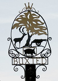
 Buxted village sign | |
Location within East Sussex | |
| Area | 21.6 km2 (8.3 sq mi) [1] |
| Population | 3,343 (2011)[2] |
| • Density | 376/sq mi (145/km2) |
| OS grid reference | TQ499234 |
| • London | 37 miles (60 km) NNW |
| Civil parish |
|
| District | |
| Shire county | |
| Region | |
| Country | England |
| Sovereign state | United Kingdom |
| Post town | UCKFIELD |
| Postcode district | TN22 |
| Dialling code | 01825 |
| Police | Sussex |
| Fire | East Sussex |
| Ambulance | South East Coast |
| UK Parliament | |
| Website | Buxted Parish |
Buxted is a village and civil parish in the Wealden district of East Sussex in England. The parish is situated on the Weald, north of Uckfield; the settlements of Five Ash Down, Heron's Ghyll and High Hurstwood are included within its boundaries. At one time its importance lay in the Wealden iron industry, and later it became commercially important in the poultry and egg industry.[3]
The village has both road (the high street is also the A272) and rail links to Uckfield and to London via Oxted.
- ^ "East Sussex in Figures". East Sussex County Council. Retrieved 26 April 2008.
- ^ "Civil Parish population 2011". Retrieved 8 October 2015.
- ^ "Buxted Parish Plan" (PDF). Buxted Parish Council. 2006. p. 3. Archived from the original (PDF) on 12 October 2006. Retrieved 16 March 2009.
