This article needs additional citations for verification. (January 2009) |
Byron | |
|---|---|
Neighbourhood | |
 | |
| Coordinates: 42°57′14″N 81°19′56″W / 42.95389°N 81.33222°W | |
| Country | |
| Province | |
| City | London |
| Settled | 1880 (as Westminster) |
| Incorporated (village) | 1804 (as Hall's Mill) |
| Amalgamation (city) | 1961 (as London) |
| Government | |
| • Type | Municipal (Ward 9) |
| • Administrative body | London City Council |
| • Councillor | Anna Hopkins |
| Elevation | 254 m (833 ft) |
| Population (2011) | |
| • Total | 15,525 |
| • Average Income | $130,587 |
| Time zone | UTC-5 (Eastern Time Zone) |
| • Summer (DST) | UTC-6 (Eastern Time Zone) |
| Postal Code | N6P |
| Area code(s) | 519, 226 |
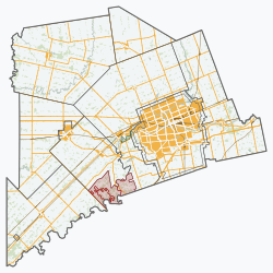
Byron is a neighbourhood in the City of London, Ontario, Canada. It is adjacent to the Thames River in the south-west of London. Almost all of its residents live in low-density, single detached dwellings. As of 2011, the area is home to 15,525 residents. [1] The neighbourhood is considered a high-income area, with an average family income of $130,587 an average dwelling value of $312,896 and a home ownership rate of 93%.[1]

