| Cache River | |
|---|---|
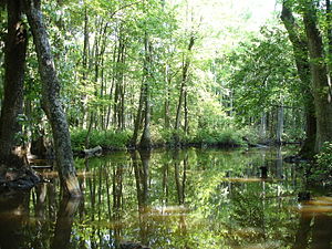
 Cache River, Woodruff County | |
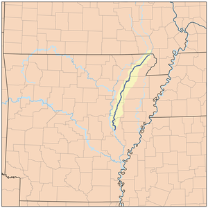
 Map of the Cache River | |
| Location | |
| Country | United States |
| State | Arkansas |
| City | Clarendon |
| Physical characteristics | |
| Source | Unnamed drainage ditches |
| • location | Butler County, Missouri |
| • coordinates | 36°13′40″N 90°36′42″W / 36.22778°N 90.61167°W |
| Mouth | White River (Arkansas) |
• location | Clarendon, Arkansas |
• coordinates | 34°42′7″N 91°19′30″W / 34.70194°N 91.32500°W |
• elevation | 151 ft (46 m)[1] |
| Length | 213 mi (343 km) |
| Discharge | |
| • location | Cotton Plant, Arkansas |
| • average | 1,461 cu/ft. per sec.[2] |
| Basin features | |
| Tributaries | |
| • right | Bayou De View |
| Protection status | |
| Official name | Cache-Lower White Rivers |
| Designated | 21 November 1989 |
| Reference no. | 442[3] |
The Cache River is a tributary of the White River, 213 mi (343 km) long, in northeastern Arkansas in the United States. Its headwaters also drain a small portion of southeastern Missouri. Via the White River, the Cache is part of the Mississippi River watershed, placing the river and surrounding watershed in the Arkansas Delta.
- ^ "Cache River". Geographic Names Information System. United States Geological Survey. Retrieved 2014-01-11.
- ^ "USGS Current Conditions for USGS 07077555 Cache River near Cotton Plant, AR".
- ^ "Cache-Lower White Rivers". Ramsar Sites Information Service. Retrieved 25 April 2018.