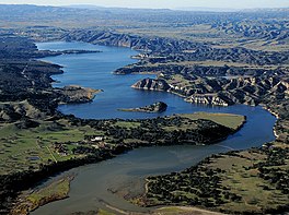
| Cachuma Lake | |
|---|---|
 | |
| Location | Los Padres National Forest Santa Barbara County, California |
| Coordinates | 34°35′12″N 119°58′52″W / 34.5866555°N 119.9809753°W |
| Type | Reservoir |
| Primary inflows | California Aqueduct Santa Ynez River |
| Primary outflows | Santa Ynez River |
| Basin countries | United States |
| Surface area | 3,100 acres (1,300 ha) |
| Average depth | 71 ft (22 m) |
| Max. depth | 150 ft (46 m) |
| Water volume | 205,000 acre⋅ft (253,000,000 m3) |
| Shore length1 | 22.44 mi (36.11 km) |
| Surface elevation | 753 ft (230 m) |
| 1 Shore length is not a well-defined measure. | |
Cachuma Lake is a reservoir in the Santa Ynez Valley of central Santa Barbara County, California on the Santa Ynez River adjoining the north side of California State Route 154. The artificial lake was created by the construction of Bradbury Dam, a 201 ft (61 m) earth-fill structure built by the U.S. Bureau of Reclamation in 1953. Its surface area covers 3,100 acres (1,300 ha), with a maximum design capacity of 205,000 acre⋅ft (253,000,000 m3), but it is currently limited to 188,000 acre⋅ft (232,000,000 m3) due to sediment accumulation.[1] The late-December 2022 and early-January 2023 storms dramatically raised the water level in the lake, from an average of 33% full to 100% full for the first time in 12 years.
- ^ "LAKE CACHUMA DAILY OPERATIONS" (PDF). January 23, 2017. Retrieved January 28, 2017.

