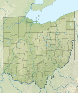
| Caesar Creek State Park | |
|---|---|
 | |
| Location | Clinton, Greene & Warren counties, Ohio, United States |
| Coordinates | 39°29′30″N 84°02′21″W / 39.49167°N 84.03917°W[1] |
| Area | Land: 4,700 acres (1,900 ha) Water: 2,830 acres (1,150 ha)[2] |
| Elevation | 843 ft (257 m)[1] |
| Established | 1978 |
| Administered by | Ohio Department of Natural Resources |
| Designation | Ohio state park |
| Website | Caesar Creek State Park |
| Caesar Creek Lake | |
|---|---|
 | |
| Location | Warren / Clinton counties, Ohio, United States |
| Coordinates | 39°29′07″N 84°03′55″W / 39.48528°N 84.06528°W[3] |
| Lake type | Reservoir |
| Primary inflows | Caesar Creek |
| Primary outflows | Caesar Creek |
| Basin countries | United States |
| Max. length | 6.4 miles (10.3 km) |
| Max. width | 1.5 miles (2.4 km) |
| Surface area | 2,830 acres (1,150 ha) |
| Shore length1 | 36.3 miles (58.4 km) |
| Surface elevation | 797 ft (243 m)[3] |
| 1 Shore length is not a well-defined measure. | |
Caesar Creek State Park is a public recreation area located in southwestern Ohio, five miles (8 km) east of Waynesville, in Warren, Clinton, and Greene counties.[2] The park is leased by the State from the U.S. Army Corps of Engineers, who in the 1970s erected a dam on Caesar Creek to impound a 2,830-acre (1,150 ha) lake.[2] The total park area, including the lake, is 7,530-acre (3,050 ha).
Fossil collection is allowed at Caesar Creek State Park with the following restrictions: No tools allowed, no fossil collecting for commercial use, all fossils kept must fit in the palm of your hand, and all fossil collection must take place in the designated fossil collection zone.[4]
- ^ a b "Caesar Creek State Park". Geographic Names Information System. United States Geological Survey, United States Department of the Interior.
- ^ a b c Cite error: The named reference
odnrwas invoked but never defined (see the help page). - ^ a b "Caesar Creek Lake". Geographic Names Information System. United States Geological Survey, United States Department of the Interior.
- ^ "Louisville District > Missions > Civil Works > Recreation > Lakes > Caesar Creek Lake > Fossil Collecting". www.lrl.usace.army.mil. Retrieved March 20, 2021.


