Cairo, Nebraska | |
|---|---|
 Welcome sign on Nebraska Highway 11 at northern edge of Cairo, December 2009 | |
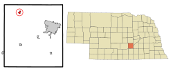
 Location of Cairo, Nebraska | |
| Coordinates: 41°00′17″N 98°36′02″W / 41.00472°N 98.60056°W | |
| Country | United States |
| State | Nebraska |
| County | Hall |
| Area | |
• Total | 0.95 sq mi (2.47 km2) |
| • Land | 0.95 sq mi (2.47 km2) |
| • Water | 0.00 sq mi (0.00 km2) |
| Elevation | 1,952 ft (595 m) |
| Population (2020) | |
• Total | 822 |
| • Density | 862.54/sq mi (333.11/km2) |
| Time zone | UTC-6 (Central (CST)) |
| • Summer (DST) | UTC-5 (CDT) |
| ZIP code | 68824 |
| Area code | 308 |
| FIPS code | 31-07625[3] |
| GNIS feature ID | 2397524[2] |
Cairo (/ˈkɛəroʊ/ KAIR-oh)[4] is a village in Hall County, Nebraska, United States. The population was 785 at the 2010 census. It is part of the Grand Island, Nebraska Micropolitan Statistical Area.
- ^ "ArcGIS REST Services Directory". United States Census Bureau. Retrieved September 18, 2022.
- ^ a b U.S. Geological Survey Geographic Names Information System: Cairo, Nebraska
- ^ "U.S. Census website". United States Census Bureau. Retrieved January 31, 2008.
- ^ Nebraska Pronunciation Guide. Associated Press. Archived March 10, 2010, at the Wayback Machine Retrieved February 11, 2010. Archived from original Archived March 12, 2010, at the Wayback Machine 2010-10-06.