Caloocan
Kalookan | |
|---|---|
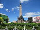
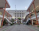
Caloocan City Hall Thai To Taoist Temple | |
| Motto: Aksyon at Malasakit | |
| Anthem: "Mabuhay ang Caloocan" | |
 Location of Caloocan within Metro Manila | |
Location within the Philippines | |
| Coordinates: 14°39′N 120°58′E / 14.65°N 120.97°E | |
| Country | Philippines |
| Region | National Capital Region |
| Province | none |
| District | 1st to 3rd district |
| Founded | 1815 |
| Cityhood | February 16, 1962 |
| Highly urbanized city | December 22, 1979 |
| Barangays | 193 (see Barangays) |
| Government | |
| • Type | Sangguniang Panlungsod |
| • Mayor | Dale Gonzalo Malapitan (NP) |
| • Vice Mayor | Anna Karina Teh-Limsico (NP) |
| • Representatives |
|
| • City Council | Members |
| • Electorate | 700,279 voters (2022) |
| Area | |
• Total | 55.80 km2 (21.54 sq mi) |
| Elevation | 30 m (100 ft) |
| Highest elevation | 514 m (1,686 ft) |
| Lowest elevation | −2 m (−7 ft) |
| Population (2020 census)[3] | |
• Total | 1,661,584 |
| • Rank | 4th |
| • Density | 30,000/km2 (77,000/sq mi) |
| • Households | 404,252 |
| Economy | |
| • Income class | 1st city income class |
| • Poverty incidence | 4.20 |
| • Revenue | ₱ 6,812 million (2020) |
| • Assets | ₱ 26,513 million (2022) |
| • Expenditure | ₱ 8,501 million (2020) |
| • Liabilities | ₱ 9,939 million (2020) |
| Service provider | |
| • Electricity | Manila Electric Company (Meralco) |
| Time zone | UTC+8 (PST) |
| PSGC | |
| IDD : area code | +63 (0)02 |
| Native languages | Tagalog |
| Catholic diocese | Roman Catholic Diocese of Kalookan |
| Patron saint | St. Roch |
| Website | caloocancity |
Caloocan, officially the City of Caloocan (Filipino: Lungsod ng Kalookan; IPA: [kalɔˈʔokan]), is a highly urbanized city in Metro Manila, Philippines. According to the 2020 census, it has a population of 1,661,584 people[3] making it the fourth-most populous city in the Philippines.
Caloocan is divided into two geographical locations with a total combined area of 5,333.40 hectares (13,179.1 acres), a result of the 1949 expansion of Quezon City, which absorbed much of its territory. It was formerly part of the Province of Rizal in southern Luzon. It comprises what is known as the CAMANAVA area along with the cities of Malabon, Navotas and Valenzuela.
South Caloocan is bordered by Manila, Quezon City, Malabon, Navotas and Valenzuela. The presence of commercial and industrial activities combined with residential areas make it a highly urbanized central business district and a major urban center in the Northern District of Metropolitan Manila.[5] North Caloocan shares its border with Quezon City and Valenzuela, Marilao, Meycauayan and San Jose del Monte in the province of Bulacan, and Rodriguez in the province of Rizal. It is composed of mostly residential subdivisions and extensive resettlement areas with scattered distribution of industrial estates mostly within road transit points and intersections.[5]
- ^ City of Caloocan | (DILG)
- ^ "2015 Census of Population, Report No. 3 – Population, Land Area, and Population Density" (PDF). Philippine Statistics Authority. Quezon City, Philippines. August 2016. ISSN 0117-1453. Archived (PDF) from the original on May 25, 2021. Retrieved July 16, 2021.
- ^ a b Census of Population (2020). "National Capital Region (NCR)". Total Population by Province, City, Municipality and Barangay. Philippine Statistics Authority. Retrieved July 8, 2021.
- ^ "PSA Releases the 2021 City and Municipal Level Poverty Estimates". Philippine Statistics Authority. April 2, 2024. Retrieved April 28, 2024.
- ^ a b "Comprehensive Land Use Plan Report, City of Caloocan (1995-2020) - Free Download PDF". kupdf.net.


