| Calore | |
|---|---|
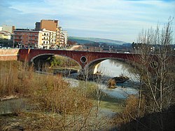
 The Calore at Benevento | |
 Map of the Calore River and its three main tributaries | |
| Location | |
| Country | Italy |
| Physical characteristics | |
| Source | |
| • location | Monte Cervialto, Monti Picentini |
| • elevation | 1,809 m (5,935 ft) |
| Mouth | Volturno |
• coordinates | 41°11′06″N 14°27′46″E / 41.18500°N 14.46278°E |
| Length | 108 km (67 mi) |
| Basin size | 3,085 square kilometres (1,191 sq mi) |
| Discharge | |
| • average | 31.8 m3/s (1,120 cu ft/s) |
| Basin features | |
| Progression | Volturno→ Tyrrhenian Sea |
| Tributaries | |
| • left | Sabato |
| • right | Ufita, Tammaro |
The Calore Irpino or Calore Beneventano or Calore river is a river in southwestern Italy. It rises from Colle Finestra (1,060 metres (3,480 ft) above sea level), a mountain saddle between Monte Acellica and the Terminio sub-group in the Monti Picentini, sub-range of the Apennine Mountains. The river flows first in the province of Avellino, and then in that of Benevento, before flowing into the Volturno. In ancient times it was known as Calor.