Calumet Heights | |
|---|---|
| Community Area 48 - Calumet Heights | |
 | |
 Location within the city of Chicago | |
| Coordinates: 41°43′42″N 87°34′47″W / 41.72833°N 87.57972°W | |
| Country | United States |
| State | Illinois |
| County | Cook |
| City | Chicago |
| Neighborhoods | list
|
| Area | |
| • Total | 1.77 sq mi (4.58 km2) |
| Population (2020) | |
| • Total | 13,088 |
| • Density | 7,400/sq mi (2,900/km2) |
| Demographics 2015[1] | |
| • White | 2.24% |
| • Black | 93.47% |
| • Hispanic | 3.23% |
| • Asian | 0.04% |
| • Other | 1.03% |
| Time zone | UTC-6 (CST) |
| • Summer (DST) | UTC-5 (CDT) |
| ZIP Codes | parts of 60617, 60619 |
| Median household income | $49,923[1] |
| Source: U.S. Census, Record Information Services | |
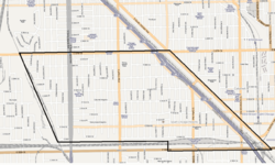
Calumet Heights, located on the South Side of the city, is one of the 77 well defined community areas of Chicago, Illinois. Calumet Heights is bounded by 87th Street on the north, South Chicago Avenue on the east, and railroad lines on the west and south (along 95th Street).
- ^ a b "Community Data Snapshot - Calumet Heights" (PDF). cmap.illinois.gov. MetroPulse. Retrieved November 28, 2017.