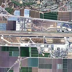
Camarillo Airport | |||||||||||||||
|---|---|---|---|---|---|---|---|---|---|---|---|---|---|---|---|
 2006 USGS photo | |||||||||||||||
| Summary | |||||||||||||||
| Airport type | Public | ||||||||||||||
| Owner | County of Ventura | ||||||||||||||
| Location | Camarillo, California, US | ||||||||||||||
| Elevation AMSL | 77 ft / 23 m | ||||||||||||||
| Coordinates | 34°12′50″N 119°05′40″W / 34.21389°N 119.09444°W | ||||||||||||||
| Website | vcairports | ||||||||||||||
 | |||||||||||||||
| Runways | |||||||||||||||
| |||||||||||||||
| Helipads | |||||||||||||||
| |||||||||||||||
| Statistics (2020) | |||||||||||||||
| |||||||||||||||
Camarillo Airport (ICAO: KCMA, FAA LID: CMA) is a public airport located three miles (5 km) west of the central business district of Camarillo, a city in Ventura County, California, United States.[1] The airport has one runway and serves privately operated general aviation and executive aircraft with no scheduled commercial service. A separate airfield[clarification needed] in the southwest quadrant of the airport is for exclusive use of light-sport aircraft and ultralights. The airport is the site for an annual air show "Wings Over Camarillo", organized by the Southern California Wing of the Commemorative Air Force.[2]
According to the US Federal Aviation Administration's National Plan of Integrated Airport Systems for 2011–2015, it is categorized as a reliever airport.[3]