| Cameroonian Highlands forests | |
|---|---|
 | |
 Map of the Cameroonian Highlands forests | |
| Ecology | |
| Realm | Afrotropical |
| Biome | tropical and subtropical moist broadleaf forests |
| Borders | |
| Geography | |
| Area | 38,000 km2 (15,000 sq mi) |
| Countries | |
| Coordinates | 6°N 11°E / 6°N 11°E |
| Conservation | |
| Conservation status | Critical/endangered[1] |
| Protected | 6.9%[2] |
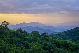
The Cameroonian Highlands forests, also known as the Cameroon Highlands forests, is a montane tropical moist broadleaf forest ecoregion located on the range of mountains that runs inland from the Gulf of Guinea and forms the border between Cameroon and Nigeria. This is an area of forest and grassland which has become more populous as land is cleared for agriculture.[3][4]
- ^ "Cameroonian Highlands forests". Terrestrial Ecoregions. World Wildlife Fund.
- ^ "Cameroonian Highlands forests". DOPA Explorer. Accessed 7 August 2021. [1]
- ^ "Map of Ecoregions 2017". Resolve. Retrieved August 20, 2021.
- ^ "Cameroonian Highlands forests". The Encyclopedia of Earth. Retrieved August 20, 2021.