| Campgaw Mountain | |
|---|---|
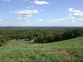
 Ski slope in Campgaw Mountain Reservation | |
| Highest point | |
| Elevation | 752 ft (229 m)[1] |
| Coordinates | 41°03′15″N 74°11′57″W / 41.05426°N 74.19919°W[2] |
| Geography | |
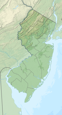
| Location | Bergen County, New Jersey, U.S. |
| Topo map | USGS Ramsey |
| Geology | |
| Rock age | 200,000,000 years |
| Mountain type | extrusive igneous / trap rock |
| Climbing | |
| Easiest route | Hike |
Campgaw Mountain is the northernmost ridge of the volcanically formed Watchung Mountains, along the border of Franklin Lakes, Oakland, and Mahwah in Bergen County, New Jersey, United States. Located almost entirely within the bounds of Campgaw Mountain Reservation, the mountain offers numerous outdoor recreational opportunities, including the only ski slope in the Watchungs.[3] Campgaw Mountain is commonly considered to be part of the greater Ramapo Mountains region,[4] but the flora and geology of the mountain is quite different from the surrounding area and more closely resembles the nearby Preakness Range to the south.[5]
- ^ Lewis, Joseph Volney & Kümmel, Henry Barnard. Geological Survey of New Jersey - Bulletin 14 The Geology of New Jersey. 1915. See Page 29 Geographic Provinces: Piedmont - Watchung Mountains. Available via Google Books
- ^ "Campgaw Mountain". Geographic Names Information System. United States Geological Survey, United States Department of the Interior. Retrieved 2009-10-25.
- ^ Holste, Elizabeth. Skiing in New Jersey? (self-published) 2005. ISBN 978-1-4116-6037-3. See Page 65, Campgaw Mountain Limited preview available via Google Books
- ^ Campgaw Mountain County Reservation. New York-New Jersey Trail Conference, 2009. Accessed October 25, 2009.
- ^ Griffith, Glenn E. and James M. Omernik (Lead Authors); Environmental Protection Agency (Content source); Mark McGinley (Topic Editor). 2009. "Ecoregions of New Jersey (EPA)." In: Encyclopedia of Earth. Eds. Cutler J. Cleveland (Washington, D.C.: Environmental Information Coalition, National Council for Science and the Environment). Published in the Encyclopedia of Earth February 5, 2009; Retrieved October 25, 2009. View the Article. Original version available on the U.S. EPA website.

