This article includes a list of general references, but it lacks sufficient corresponding inline citations. (September 2014) |
| Candlewood Lake | |
|---|---|
 Candlewood Lake, October 2011 | |
| Location | Fairfield / Litchfield counties, Connecticut, US |
| Coordinates | 41°29′N 73°27′W / 41.49°N 73.45°W |
| Lake type | Reservoir |
| Primary inflows | Rocky River, Housatonic River |
| Primary outflows | Rocky River, Housatonic River |
| Basin countries | United States |
| Max. length | 11 mi (18 km) |
| Max. width | 2 mi (3.2 km) widest point |
| Surface area | 5,420 acres (21.9 km2)[1] |
| Average depth | 40 ft (12 m) |
| Max. depth | 90 ft (27 m) |
| Water volume | 167,112 acre-feet (206,130,000 m3) |
| Shore length1 | 60 mi (97 km) |
| Surface elevation | 429 ft (131 m) |
| Islands | 12 |
| Settlements | Brookfield, Danbury, New Fairfield, New Milford, and Sherman |
| 1 Shore length is not a well-defined measure. | |
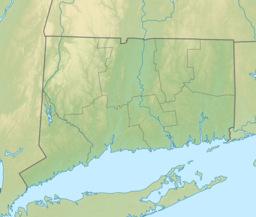
Candlewood Lake is a manmade lake located in Fairfield and Litchfield counties of Western Connecticut, in the northeastern United States. At 8.4 square miles (22 km2), it is the largest lake in Connecticut and the largest lake in the New York Metropolitan Area.[2] The lake is bordered by the city of Danbury, and the towns of Brookfield, New Fairfield, New Milford, and Sherman.[1] Some of the most expensive real estate in the Greater Danbury area is located along the shores of the lake.[3]
- ^ a b "Creating Candlewood Lake – Today in History: July 15". connecticuthistory.org. Connecticut Humanities. Retrieved 17 August 2015.
- ^ Corrigan, Richard. "Swimming at Candlewood Lake, Connecticut". USA Today. Retrieved 17 August 2015.
- ^ "These multi-million dollar homes on Candlewood Lake are on the market". The News-Times. July 6, 2021. Retrieved December 4, 2022.


