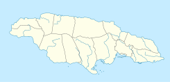
| Cane River | |
|---|---|
 | |
| Location | |
| Country | Jamaica |
| Physical characteristics | |
| Source | |
| • coordinates | 18°00′54″N 76°41′34″W / 18.015039°N 76.692746°W[1] |
| • elevation | 3,500 ft (1,100 m)[1] |
| 2nd source | |
| • coordinates | 18°01′17″N 76°42′21″W / 18.0213439°N 76.7057276°W[1] |
| • elevation | 2,700 ft (820 m)[1] |
| Mouth | |
• coordinates | 17°56′37″N 76°41′50″W / 17.943574°N 76.697134°W[1] |
• elevation | Sea level[1] |
The Cane River rises at twin sources in the vicinity of Derby Peak in eastern Saint Andrew Parish, Jamaica from where it flows south to the Caribbean Sea.[1]
