| Canim Lake | |
|---|---|
&sq=&lang=&file=File:Canim_Lake_Lookout.jpg) | |
&sq=&lang=&file=File:Canada_British_Columbia_relief_location_map.jpg) Canim Lake | |
 | |
| Location | British Columbia, Canada |
| Coordinates | 51°51′47″N 120°45′56″W / 51.86314°N 120.76542°W |
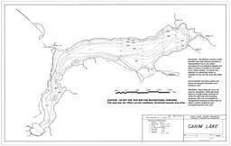
| Primary inflows | Bridge Creek, Eagle Creek, Jim Creek, Boss Creek |
| Primary outflows | Canim River |
| Basin countries | Canada |
| Max. length | 26.5 km (16 mi) |
| Surface area | 56.1 km2 (22 sq mi) |
| Average depth | 84.1 m (276 ft) |
| Max. depth | 208.5 m (684 ft) |
| Water volume | 4.7 km3 (1 cu mi) |
| Surface elevation | 772.4 m (2,534 ft) |
| Frozen | Rarely |
| Islands | Eagle Island, Canoe Island, Round Island, Sunken Island/Reef |
Canim Lake /ˈkænɪm/ is a lake in British Columbia, Canada. Its west end is 36 km (22.4 mi) northeast of 100 Mile House. "Canim" means a type of large canoe in the Chinook Jargon. Canim Lake is 26.5 km (16.5 mi) long. It is also part of the territory of the Shuswap First Nation where the ancestors are part of the Lake Division of the Shuswap nation of the Interior Nations of British Columbia. The Reilly Commission states that the 2,029 hectares region around Canim Lake are set aside for the Shuswap First Nation. In the summer of 1995, there was an archaeological evidence of an ancient civilization and evidence of carbon dated as 4,300 old.[1]
- ^ "Canim Lake". Travel British Columbia. Retrieved 30 March 2014.