32°00′S 115°51′E / 32.000°S 115.850°E
| Canning River Nyungar: Djarlgarra | |
|---|---|
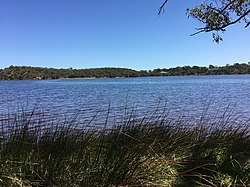
 Canning River from southern shore looking north towards Mount Henry overlooking Aquinas Bay | |
 | |
| Location | |
| Country | Australia |
| State | Western Australia |
| City | Perth |
| Physical characteristics | |
| Source | |
| • location | Wandering[1] |
| Mouth | Swan River |
• location | Melville Water |
• coordinates | 32°00′11″S 115°51′02″E / 32.0031568°S 115.8506084°E |
| Length | 110 km (68 mi) |
| Basin features | |
| Tributaries | |
| • left | Bull Creek, Bannister Creek, Lambertia Creek, Southern River, Churchmans Brook |
| • right | Yule Brook, Bickley Brook, Ellis Brook, Stoney Brook, Stinton Creek |
The Canning River (Nyungar: Djarlgarra[2][3] or Nyungar: Dyarlgarro[4]) is a major tributary of the Swan River in the South West Land Division of Western Australia. It is home to much wildlife including dolphins, pelicans, swans and many other bird species.
- ^ "About the river system". Parks and Wildlife Service. Retrieved 18 October 2018.
- ^ Kinsella, John (2017). Polysituatedness: A Poetics of Displacement. Oxford University Press. ISBN 978-1526113375.
- ^ Rivers of emotion : an emotional history of Derbarl Yerrigan and Djarlgarro Beelier : the Swan and Canning rivers. Broomhall, Susan., Pickering, Gina., Australian Research Council. Centre of Excellence. History of Emotions., National Trust of Australia (W.A.). [Crawley, W.A.]: ARC Centre of Excellence History of Emotions. 2012. ISBN 9781740522601. OCLC 820979809.
{{cite book}}: CS1 maint: others (link) - ^ "Discover the Swan and Canning rivers | Department of Biodiversity, Conservation and Attractions". www.dbca.wa.gov.au. Retrieved 2 June 2023.