Cannonville, Utah | |
|---|---|
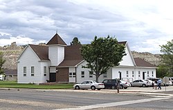
 LDS church in Cannonville | |
| Nickname(s): Shotgun (Before a new family moved in, then they called it Cannonville) | |
| Motto: | |
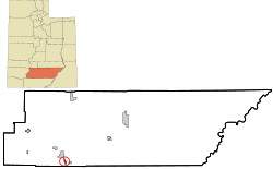
 Location in Garfield County and state of Utah | |
| Coordinates: 37°34′0″N 112°3′6″W / 37.56667°N 112.05167°W | |
| Country | United States |
| State | Utah |
| County | Garfield |
| Founded | 1874 |
| Incorporated | 1934 |
| Founded by | James L. Thompson |
| Named for | George Q. Cannon |
| Government | |
| • Mayor | Bill Scoffield |
| • Clerk | Tom Shakespear |
| Area | |
| • Total | 2.57 sq mi (6.65 km2) |
| • Land | 2.57 sq mi (6.65 km2) |
| • Water | 0.00 sq mi (0.00 km2) |
| Elevation | 5,886 ft (1,794 m) |
| Population (2020) | |
| • Total | 186 |
| • Estimate (2019)[3] | 173 |
| • Density | 67.42/sq mi (26.03/km2) |
| Time zone | UTC-7 (Mountain (MST)) |
| • Summer (DST) | UTC-6 (MDT) |
| ZIP code | 84718 |
| Area code | 435 |
| FIPS code | 49-10330[4] |
| GNIS feature ID | 1426344[2] |
Cannonville is a town in Garfield County, Utah, United States, along Utah Scenic Byway 12. As of the 2020 census, the population was 186.[5]
- ^ "2019 U.S. Gazetteer Files". United States Census Bureau. Retrieved August 7, 2020.
- ^ a b U.S. Geological Survey Geographic Names Information System: Cannonville, Utah
- ^ Cite error: The named reference
USCensusEst2019CenPopScriptOnlyDirtyFixDoNotUsewas invoked but never defined (see the help page). - ^ "U.S. Census website". United States Census Bureau. Retrieved 2008-01-31.
- ^ "Explore Census Data". data.census.gov. Retrieved 2024-04-11.
