Cantal | |
|---|---|
|
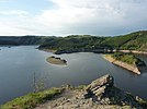
From top down, left to right: Château de Réghaud in Sénezergues, Rhue River, Truyère River, Cheylade | |
 Location of Cantal in France | |
| Coordinates: 45°2′N 3°6′E / 45.033°N 3.100°E | |
| Country | France |
| Region | Auvergne-Rhône-Alpes |
| Prefecture | Aurillac |
| Subprefectures | Mauriac Saint-Flour |
| Government | |
| • President of the Departmental Council | Bruno Faure[1] (LR) |
| Area | |
• Total | 5,726 km2 (2,211 sq mi) |
| Population (2021)[2] | |
• Total | 144,226 |
| • Rank | 98th |
| • Density | 25/km2 (65/sq mi) |
| Time zone | UTC+1 (CET) |
| • Summer (DST) | UTC+2 (CEST) |
| Department number | 15 |
| Arrondissements | 3 |
| Cantons | 15 |
| Communes | 246 |
| ^1 French Land Register data, which exclude estuaries and lakes, ponds and glaciers larger than 1 km2 | |
Cantal (French pronunciation: [kɑ̃tal] ; Occitan: Cantal or Cantau) is a rural department in the Auvergne-Rhône-Alpes region of France, with its prefecture in Aurillac. Its other principal towns are Saint-Flour (the episcopal see) and Mauriac; its residents are known as Cantalians (French: Cantaliens / Cantaliennes or Cantalous / Cantaloues). Cantal borders the departments of Puy-de-Dôme, Haute-Loire, Aveyron, Lot, Lozère and Corrèze, in the Massif Central natural region.
Along with neighbouring Lozère and Creuse, Cantal is among the most sparsely populated and geographically isolated departments of France and Aurillac is the departmental capital farthest removed from a major motorway. It had a population of 144,692 in 2019,[3] making it the country's 98th most populated department. Of the 96 metropolitan departments, it is the fifth least populated.
- ^ "Répertoire national des élus: les conseillers départementaux". data.gouv.fr, Plateforme ouverte des données publiques françaises (in French). 4 May 2022.
- ^ "Téléchargement du fichier d'ensemble des populations légales en 2021" (in French). The National Institute of Statistics and Economic Studies. 28 December 2023.
- ^ Populations légales 2019: 15 Cantal, INSEE


