Cantley | |
|---|---|
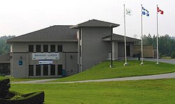
 Cantley Town Hall | |
 Location within Les Collines-de-l'Outaouais RCM | |
| Coordinates: 45°34′N 75°47′W / 45.567°N 75.783°W[1] | |
| Country | Canada |
| Province | Quebec |
| Region | Outaouais |
| RCM | Les Collines-de-l'Outaouais |
| Constituted | January 1, 1989 |
| Government | |
| • Mayor | David Gomes |
| • Federal riding | Pontiac |
| • Prov. riding | Gatineau |
| Area | |
| • Total | 133.85 km2 (51.68 sq mi) |
| • Land | 126.24 km2 (48.74 sq mi) |
| Population (2021)[4] | |
| • Total | 11,449 |
| • Density | 90.8/km2 (235/sq mi) |
| Time zone | UTC−05:00 (EST) |
| • Summer (DST) | UTC−04:00 (EDT) |
| Postal code(s) | |
| Area code | 819 |
| Highways | |
| Website | www |
Cantley is a rural municipality in Quebec, Canada, north of the city of Gatineau, east of the Gatineau River, located within Canada's National Capital Region approximately 17 km (11 mi) from Parliament Hill. Cantley is one of six municipalities within the Collines-de-l'Outaouais Regional County Municipality. Its roots are in farmland and mining, but recent housing projects since its creation in 1989 have resulted in a high rate of population growth. The population at the 2021 Canadian Census was 11,449, an increase of 7.0% from the 2016 population of 10,699.[4] French is the first language of 86.7% of Cantley's residents.[3]
- ^ Cite error: The named reference
toponymiewas invoked but never defined (see the help page). - ^ a b Cite error: The named reference
mamrotwas invoked but never defined (see the help page). - ^ a b "Census Profile, 2016 Census: Cantley, Municipalité [Census subdivision], Quebec". 2016 Canadian Census. Statistics Canada. Retrieved July 27, 2019.
- ^ a b "Census Profile, 2021 Census: Cantley, Municipalité [Census subdivision], Quebec". 2021 Canadian Census. Statistics Canada. Retrieved February 24, 2022.
