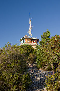
Cantonment Hill
Dwerda Weelardinup, Walyarup | |
|---|---|
 Cantonment Hill signal station | |
 | |
| Coordinates: 32°2′37″S 115°45′19″E / 32.04361°S 115.75528°E | |
| Location | Fremantle, Western Australia |
| Operator | City of Fremantle |
| Area | |
| • Total | 2.31 hectares (5.7 acres) |
| Elevation | 33.9 m (111.2 ft) |
 | |
Cantonment Hill is a small rise overlooking the port city of Fremantle, Western Australia. Since the early 1900s the hill and the surrounding 4-hectare (9.9-acre) precinct has been mainly used for military purposes with extensive buildings now present. It has been under the control of the Department of Defence.
The area is known by the indigenous Whadjuk people as Dwerda Weelardinup, meaning "place of the dingo spirit" and the peak is also referred to as Walyarup, meaning "sea-eagle nest".[1]
The site includes the last remaining stand of pre-European settlement Rottnest Island pine (Callitris preissii) on the mainland of Western Australia.[2]
- ^ "Cantonment Hill Master plan". City of Fremantle. 18 June 2012. Archived from the original on 22 March 2015. Retrieved 30 May 2015.
- ^ Cite error: The named reference
Parkewas invoked but never defined (see the help page).