 An 1890 map of the island | |
| Geography | |
|---|---|
| Location | Casamance River |
| Archipelago | Islands of the Casamance delta |
| Area | 57 km2 (22 sq mi) |
| Highest elevation | 2 m (7 ft) |
| Highest point | unnamed |
| Administration | |
Senegal | |
| Region | Ziguinchor |
| Department | Oussouye |
| Demographics | |
| Population | 396 (2003) |
| Pop. density | 7/km2 (18/sq mi) |
| Ethnic groups | Jola |
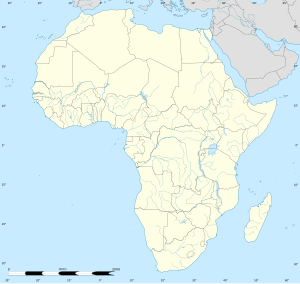
Carabane, also known as Karabane, is an island and a village located in the extreme south-west of Senegal, in the mouth of the Casamance River. This relatively recent geological formation consists of a shoal and alluvium to which soil is added by accumulation in the branches and roots of the mangrove trees which cover most of the island. Along with the rest of Ziguinchor Region, Carabane has a tropical climate, cycling between a dry season and a wet season. The island was once considered an arid location where no useful plants were likely to grow, but it now supports several types of fruit tree, the most common of which are mangos and oranges. Although the nearby Basse Casamance National Park and Kalissaye Avifaunal Reserve have been closed for years because of the Casamance Conflict, Carabane has continued to attract ornithologists interested in its wide variety of birds. Various species of fish are plentiful around the island, but there are very few mammals.12°32′16″N 16°42′03″W / 12.5378°N 16.7008°W
The earliest known inhabitants of the island were the Jola, the ethnic group which is still the most populous on the island. The Portuguese were active in the region from the 16th century onwards; however, they did not linger on "Mosquito Island", the mosquitoes and black flies convincing them to establish their trading post in the town of Ziguinchor instead in 1645. On January 22, 1836, the island was ceded to France by the village leader of Kagnout in return for an annual payment of 196 francs. A series of treaties between the French and the leaders of the local peoples ensued; however, the inhabitants of Carabane did not recognize the authority of the treaties imposed upon them, resulting in lootings and abductions among French rice farmers by the Karoninka people. In 1869, Carabane became autonomous, but it merged with Sédhiou in 1886. Since World War II, the population of the island has gradually declined for a variety of reasons including periods of drought, the Casamance Conflict and, more recently, the sinking of the ferry Joola in 2002. Much of the village's ability to trade and receive tourists was lost until 2014, when MV Aline Sitoe Diatta resumed ferry services to the island.
Although Carabane was once a regional capital, the village has since become so politically isolated from the rest of the country that it no longer fits into any category of the administrative structure decreed by the Senegalese government. The Jola account for the majority of the island's population and Jola society has no formal hierarchy. The indigenous population was originally animist, but although the sacred groves and fetishes survive as cultural icons of Casamance, the monotheistic belief systems of Catholicism and Islam have become the most widely held in Carabane. The literacy rate is approximately 90%. Students attend a primary school on the island, but must move at least as far as Elinkine to continue their studies.
The testimonies of explorers and colonial administrators demonstrate that Carabane has participated in rice cultivation, fishery, trade, and palm wine production for a long time. The rice cycle plays a central economic and religious role in the lives of the population. Palm oil and palm wine are very popular and traditional in the area. The fishery has long been dominated by artisan fishing, which supplies the daily needs of the island's population; however, broader economic possibilities have been exploited since the early 20th century. Although there have been attempts to cultivate a tourism industry on the island, the inhabitants have been reluctant to participate. Carabane was added to the list of historic sites and monuments of Senegal in 2003.

