Careby Aunby and Holywell | |
|---|---|
Civil parish | |
 Hollow cottages, typical terrain for the parish | |
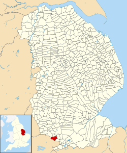
 Careby Aunby and Holywell in Lincolnshire | |
| Coordinates: 52°43′48″N 0°29′38″W / 52.730°N 0.494°W | |
| Country | England |
| Primary council | South Kesteven |
| County | Lincolnshire |
| Region | East Midlands |
| Status | Parish |
| Government | |
| • Type | Parish Council |
| • UK Parliament | Grantham and Stamford |
| Population | |
| • Total | 143 |
| Website | Careby Aunby and Holywell Parish Council |
Careby Aunby and Holywell is a civil parish in the district of South Kesteven, south-west Lincolnshire, in England.[2] It stretches from the county border with Rutland in the west to the River West Glen in the east. The B1176 road from Corby Glen passes through Careby and on past Aunby toward Stamford. The main London to Scotland railway line passes through the parish, the line upon which Mallard took the speed record for the LNER.[3]
The total population in the 2001 census was 146, falling marginally to 143 at the 2011 census.[4] The population in 1801 was 65, and had risen to 133 by 1911
The centre of the parish is near grid reference TF017157
- ^ 2001 Census data
- ^ "Civil Parish details".
- ^ Hale, Don (25 May 2008). Mallard: How the Blue Streak Broke the World Steam Speed Record. Aurum Press Ltd. ISBN 978-1845133450.
- ^ "Civil parish population 2011". Neighbourhood Statistics. Office for National Statistics. Retrieved 21 April 2016.