| Caringbah Sydney, New South Wales | |||||||||||||||
|---|---|---|---|---|---|---|---|---|---|---|---|---|---|---|---|
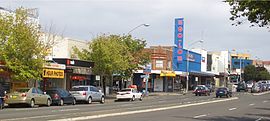
 The Kingsway, Caringbah | |||||||||||||||
 | |||||||||||||||
| Population | 12,575 (2021 census)[1] | ||||||||||||||
| Postcode(s) | 2229 | ||||||||||||||
| Elevation | 39 m (128 ft) | ||||||||||||||
| Location | 24 km (15 mi) south of Sydney CBD | ||||||||||||||
| LGA(s) | Sutherland Shire | ||||||||||||||
| State electorate(s) | |||||||||||||||
| Federal division(s) | Cook | ||||||||||||||
| |||||||||||||||
Caringbah is a suburb in Southern Sydney, in the state of New South Wales, Australia. Caringbah is 24 kilometres (15 mi) south of the Sydney central business district in the local government area of Sutherland Shire.
Caringbah once stretched from Woolooware Bay on the Georges River to Yowie Bay and Burraneer Bay on the Port Hacking estuary. A number of Caringbah localities have been declared as separate suburbs but still share the postcode 2229. These suburbs include Taren Point to the north on the Georges River, and Port Hacking, Lilli Pilli, Dolans Bay and Caringbah South, located on the Port Hacking River to the south.
- ^ Australian Bureau of Statistics (28 June 2022). "Caringbah (State Suburb)". 2021 Census QuickStats. Retrieved 7 August 2024.