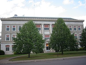
Carlton County | |
|---|---|
 | |
 Location within the U.S. state of Minnesota | |
 Minnesota's location within the U.S. | |
| Coordinates: 46°35′N 92°41′W / 46.59°N 92.68°W | |
| Country | |
| State | |
| Founded | May 23, 1857 (created) 1870 (organized)[1] |
| Named for | Reuben B. Carlton |
| Seat | Carlton |
| Largest city | Cloquet |
| Area | |
| • Total | 875 sq mi (2,270 km2) |
| • Land | 861 sq mi (2,230 km2) |
| • Water | 14 sq mi (40 km2) 1.6% |
| Population (2020) | |
| • Total | 36,207 |
| • Estimate (2023) | 36,825 |
| • Density | 42.1/sq mi (16.3/km2) |
| Time zone | UTC−6 (Central) |
| • Summer (DST) | UTC−5 (CDT) |
| Congressional district | 8th |
| Website | www |
Carlton County is a county in the State of Minnesota, formed in 1857. As of the 2020 census, the population was 36,207.[2] Its county seat is Carlton.[3] Part of the Fond du Lac Indian Reservation lies in northeastern Carlton County.
Carlton County is part of the Duluth, MN–WI Metropolitan Statistical Area.
- ^ "Minnesota Place Names". Minnesota Historical Society. Archived from the original on October 25, 2014. Retrieved March 17, 2014.
- ^ "State & County QuickFacts". United States Census Bureau. Retrieved April 14, 2023.
- ^ "Find a County". National Association of Counties. Archived from the original on May 31, 2011. Retrieved June 7, 2011.