Carmel Valley | |
|---|---|
From top down, left to right: Carmel Valley panoramio; Carmel River; Garland Ranch Regional Park; Jamesburg Earth Station | |
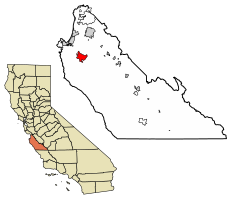
 Location of Carmel Valley in Monterey County and the state of California | |
| Coordinates: 36°28′38″N 121°44′22″W / 36.47722°N 121.73944°W | |
| Country | |
| State | |
| County | Monterey |
| Government | |
| • Board of Supervisors | Mary Adams (politician)[2] |
| • State senator | John Laird (D)[3] |
| • Assemblymember | Robert Rivas (D)[3] |
| • U. S. rep. | Jimmy Panetta (D)[4] |
| Area | |
• Total | 189.65 sq mi (491.2 km2) |
| • Land | 189.05 sq mi (489.6 km2) |
| • Water | 0.6 sq mi (2 km2) |
| Population (2020) | |
• Total | 6,189[1] |
| Time zone | UTC-8 (PST) |
| • Summer (DST) | UTC-7 (PDT) |
| ZIP code | 93924[6] |
| Area code | 831 |
| FIPS code | 0605390370 |
| GNIS feature ID | 270303 |
Carmel Valley is an unincorporated community in Monterey County, California, United States. The term "Carmel Valley" generally refers to the Carmel River watershed east of California State Route 1, and not specifically to the smaller Carmel Valley Village.[5][1] For statistical purposes, the United States Census Bureau has defined Carmel Valley as a census county division (CCD),[1] with an area covering approximately 189 square miles (490 km2).[5] At the time of the 2020 census the CCD population was 6,189.[1] In November 2009, a majority of residents voted against incorporation.
- ^ a b c d "Carmel Valley CCD, Monterey County, California". data.census.gov. Retrieved January 22, 2022.
- ^ Rahaim, Nick (June 8, 2016). "Mary Adams knocks Dave Potter off his longtime seat". Monterey County Weekly. Retrieved June 30, 2017.
- ^ a b "Statewide Database". UC Regents. Archived from the original on February 1, 2015. Retrieved November 2, 2014.
- ^ "California's 20th Congressional District - Representatives & District Map". Civic Impulse, LLC. Retrieved September 24, 2014.
- ^ a b c "2020 U.S. Gazetteer Files: California CCDs". United States Census Bureau. Retrieved April 13, 2022.
- ^ "ZIP Code(tm) Lookup". United States Postal Service. Retrieved November 9, 2014.
- ^ "Carmel Valley". Geographic Names Information System. United States Geological Survey, United States Department of the Interior.


