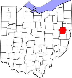
Carroll County | |
|---|---|
 | |
 Location within the U.S. state of Ohio | |
 Ohio's location within the U.S. | |
| Coordinates: 40°35′N 81°05′W / 40.58°N 81.09°W | |
| Country | |
| State | |
| Founded | January 1, 1833 |
| Named for | Charles Carroll of Carrollton |
| Seat | Carrollton |
| Largest village | Carrollton* |
| Area | |
• Total | 399 sq mi (1,030 km2) |
| • Land | 395 sq mi (1,020 km2) |
| • Water | 4.3 sq mi (11 km2) 1.1% |
| Population (2020) | |
• Total | 26,721 |
| • Density | 67/sq mi (26/km2) |
| Time zone | UTC−5 (Eastern) |
| • Summer (DST) | UTC−4 (EDT) |
| Congressional district | 6th |
| Website | www |
| |
Carroll County is a county located in the state of Ohio. As of the 2020 census, the population was 26,721.[2] Its county seat is Carrollton, while its largest village is Minerva.[3] It is named for Charles Carroll of Carrollton, the last surviving signer of the Declaration of Independence.[4][5] Carroll County is part of the Canton-Massillon, OH Metropolitan Statistical Area, which is also included in the Cleveland-Akron-Canton, OH Combined Statistical Area. It is in the Appalachian Ohio region.[6]
- ^ "Carroll County data (population)". Ohio State University Extension Data Center. Retrieved May 10, 2007.[permanent dead link]
- ^ 2020 census
- ^ "Find a County". National Association of Counties. Archived from the original on May 31, 2011. Retrieved June 7, 2011.
- ^ Taylor, William Alexander (1899). Ohio Statesmen and Annals of Progress. Press of the Westbote Company. pp. 243.
- ^ Knepper, George W. (2002). The Official Ohio Lands Book (PDF). Ohio State Auditor. p. 75. Archived (PDF) from the original on December 31, 2008.
- ^ Appalachian Regional Commission Archived September 17, 2008, at the Wayback Machine

