Carson River
| |
|---|---|
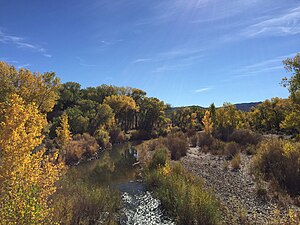
 Carson River at Dayton, Nevada | |
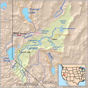
 Carson River Basin | |
| Etymology | Kit Carson |
| Native name |
|
| Location | |
| Country | United States |
| State | Nevada |
| Region | central Lahontan region |
| Physical characteristics | |
| Source | West Fork Carson River |
| • location | Carson Pass, Alpine County, CA |
| 2nd source | East Fork Carson River |
| • location | Sonora Peak, California |
| Source confluence | mouths of West & East forks |
| • location | near Minden, Nevada |
| • coordinates | 39°42′47″N 118°39′21″W / 39.71306°N 118.65583°W[3] |
| Length | 131 mi (211 km)[4] |
| Basin size | 3,930 sq mi (10,200 km2)[5] |
| Discharge | |
| • location | Carson City, NV[6] |
| • average | 400.9 cu ft/s (11.35 m3/s)[6] |
| • minimum | 1.96 cu ft/s (0.056 m3/s) |
| • maximum | 30,500 cu ft/s (860 m3/s) |
The Carson River is a northwestern Nevada river that empties into the Carson Sink, an endorheic basin. The main stem of the river is 131 miles (211 km) long[4] although the addition of the East Fork makes the total length 205 miles (330 km), traversing five counties: Alpine County in California and Douglas, Storey, Lyon, and Churchill Counties in Nevada, as well as the Consolidated Municipality of Carson City, Nevada. The river is named for Kit Carson, who guided John C. Frémont's expedition westward up the Carson Valley and across Carson Pass in winter, 1844.[7] The river made the National Priorities List (NPL) on October 30, 1990 as the Carson River Mercury Superfund site (CRMS) due to investigations that showed trace amounts of mercury in the wildlife and watershed sediments.[8]
- ^ SWCA Environmental Consultants (2002). "Northern Paiute and Western Shoshone Land Use in Northern Nevada: A Class I Ethnographic/Ethnohistoric Overview" (PDF).
- ^ Washoe Cultural Resource Office (2009). "Wa She Shu: "The Washoe People" Past and Present" (PDF).
- ^ U.S. Geological Survey Geographic Names Information System: Carson River (GNIS feature ID 859159)
- ^ a b U.S. Geological Survey. National Hydrography Dataset high-resolution flowline data. The National Map Archived 2012-03-29 at the Wayback Machine, accessed March 17, 2011
- ^ "USGS Water Resources: About USGS Water Resources".
- ^ a b "USGS Surface Water data for USA: USGS Surface-Water Monthly Statistics".
- ^ Federal Writers' Project (1941). Origin of Place Names: Nevada (PDF). W.P.A. p. 19.
- ^ "CARSON RIVER MERCURY SITE Site Profile". cumulis.epa.gov. Retrieved 2020-12-11.