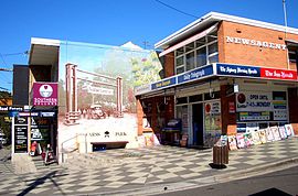
| Carss Park Sydney, New South Wales | |||||||||||||||
|---|---|---|---|---|---|---|---|---|---|---|---|---|---|---|---|
 Carwar Avenue | |||||||||||||||
 | |||||||||||||||
| Population | 1,265 (2021 census)[1] | ||||||||||||||
| Postcode(s) | 2221 | ||||||||||||||
| Elevation | 14 m (46 ft) | ||||||||||||||
| Location | 17 km (11 mi) south of Sydney CBD | ||||||||||||||
| LGA(s) | Georges River Council | ||||||||||||||
| State electorate(s) | Kogarah | ||||||||||||||
| Federal division(s) | Cook | ||||||||||||||
| |||||||||||||||

Carss Park is a suburb in southern Sydney, in the state of New South Wales, Australia 17 kilometres south of the Sydney central business district in the local government area of the Georges River Council. Carss Park is part of the St George area.
- ^ Australian Bureau of Statistics (28 June 2022). "Carss Park (State Suburb)". 2021 Census QuickStats. Retrieved 7 August 2024.