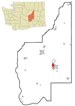
Cascade Valley, Washington | |
|---|---|
 Location of Cascade Valley, Washington | |
| Coordinates: 47°8′42″N 119°19′24″W / 47.14500°N 119.32333°W | |
| Country | United States |
| State | Washington |
| County | Grant |
| Area | |
| • Total | 4.60 sq mi (11.92 km2) |
| • Land | 2.97 sq mi (7.68 km2) |
| • Water | 1.64 sq mi (4.24 km2) |
| Elevation | 1,060 ft (323 m) |
| Population | |
| • Total | 4,332 |
| • Density | 940/sq mi (360/km2) |
| Time zone | UTC-8 (Pacific (PST)) |
| • Summer (DST) | UTC-7 (PDT) |
| ZIP code | 98837[2] |
| Area code | 509 |
| FIPS code | 53-10455[3] |
| GNIS feature ID | 1867603[4] |
Cascade Valley is a census-designated place (CDP) in Grant County, Washington, United States. The population was 2,246 at the 2010 census,[5] up from 1,811 at the 2000 census.
- ^ "Census Bureau profile: Cascade Valley, Washington". United States Census Bureau. May 2023. Retrieved May 9, 2024.
- ^ "Cascade Valley WA ZIP Code". zipdatamaps.com. 2023. Retrieved January 26, 2023.
- ^ "U.S. Census website". United States Census Bureau. Retrieved January 31, 2008.
- ^ "Cascade Valley". Geographic Names Information System. United States Geological Survey, United States Department of the Interior.
- ^ "Geographic Identifiers: 2010 Demographic Profile Data (G001): Cascade Valley CDP, Washington". American Factfinder. U.S. Census Bureau. Retrieved March 30, 2017.[dead link]