| Casselman River Bridge State Park | |
|---|---|
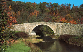
 The bridge's south aspect | |
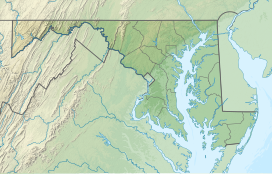
| Location | Garrett County, Maryland, United States |
| Nearest town | Grantsville, Maryland |
| Coordinates | 39°41′48″N 79°08′37″W / 39.69667°N 79.14361°W |
| Area | 4 acres (1.6 ha)[1] |
| Elevation | 2,113 ft (644 m) |
| Established | 1957 |
| Administered by | Maryland Department of Natural Resources |
| Status | Closed pending bridge repairs scheduled for 2024[2] |
| Designation | Maryland state park |
| Website | Official website |
Casselman's Bridge, National Road | |
 | |
| Location | East of Grantsville on U.S. Route 40 Alternate, Grantsville, Maryland |
| Area | < 1 acre |
| Built | 1813–1814 |
| Architect | David Shriver Jr.[3] |
| NRHP reference No. | 66000391 |
| Significant dates | |
| Added to NRHP | October 15, 1966 |
| Designated NHL | January 29, 1964 |
The Casselman Bridge is a historic transportation structure on the Casselman River, located immediately east of Grantsville in Garrett County, Maryland, and preserved by the state of Maryland as Casselman River Bridge State Park.[2][4] The bridge was built in 1813–1814 as part of the National Road. Historic markers posted at each end read:
Erected 1813 by David Shriver Jr.,
Sup't of the "Cumberland Road" (The
National Road). This 80 foot span
was the largest stone arch in America
at the time. It was continuously
used from 1813 to 1933.[5]
The structure, which has also been known as Casselmans Bridge, Castleman's Bridge, and Little Crossings Bridge, was declared a National Historic Landmark in 1964[6] and placed on the National Historic Register in 1966.[7]
- ^ Cite error: The named reference
acreagereportwas invoked but never defined (see the help page). - ^ a b Cite error: The named reference
mdnrwas invoked but never defined (see the help page). - ^ Cite error: The named reference
bicentenialwas invoked but never defined (see the help page). - ^ Cite error: The named reference
mdnr4was invoked but never defined (see the help page). - ^ Cite error: The named reference
histmarkerwas invoked but never defined (see the help page). - ^ Cite error: The named reference
nhllistingswas invoked but never defined (see the help page). - ^ Cite error: The named reference
nominationwas invoked but never defined (see the help page).

