Castalia, Ohio | |
|---|---|
 | |
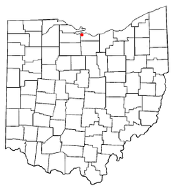
 Location of Castalia, Ohio | |
 Location of Castalia in Erie County | |
| Coordinates: 41°24′04″N 82°48′29″W / 41.40111°N 82.80806°W | |
| Country | United States |
| State | Ohio |
| County | Erie |
| Township | Margaretta |
| Government | |
| • Mayor | James R. Johnson[citation needed] |
| Area | |
| • Total | 1.03 sq mi (2.67 km2) |
| • Land | 1.02 sq mi (2.65 km2) |
| • Water | 0.01 sq mi (0.02 km2) |
| Elevation | 633 ft (193 m) |
| Population (2020) | |
| • Total | 774 |
| • Estimate (2023)[3] | 747 |
| • Density | 757.34/sq mi (292.35/km2) |
| Time zone | UTC-5 (Eastern (EST)) |
| • Summer (DST) | UTC-4 (EDT) |
| ZIP code | 44824 |
| Area code | 419 |
| FIPS code | 39-12476[4] |
| GNIS feature ID | 2397573[2] |
| Website | https://www.villageofcastalia.com |
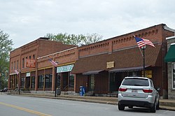
Castalia is a village in Erie County, Ohio, United States. The population was 774 at the 2020 census. It is part of the Sandusky, Ohio Metropolitan Statistical Area.
- ^ "ArcGIS REST Services Directory". United States Census Bureau. Retrieved September 20, 2022.
- ^ a b U.S. Geological Survey Geographic Names Information System: Castalia, Ohio
- ^ "Annual Estimates of the Resident Population for Incorporated Places in Ohio: April 1, 2020 to July 1, 2023". United States Census Bureau. Retrieved June 9, 2024.
- ^ "U.S. Census website". United States Census Bureau. Retrieved January 31, 2008.