Castelo Branco | |
|---|---|
Gardens of the Ancient Bishop's Palace, Agência do Banco de Portugal, View of Castelo Branco from the castle, Bishop Arch, Cross in the center, Convento da Graça | |
 | |
| Coordinates: 39°49′N 7°30′W / 39.817°N 7.500°W | |
| Country | |
| Region | Centro |
| Intermunic. comm. | Beira Baixa |
| District | Castelo Branco |
| Parishes | 19 |
| Government | |
| • President | Leopoldo Rodrigues (PS) |
| Area | |
• Total | 1,438.19 km2 (555.29 sq mi) |
| Population (2021) | |
• Total | 52,291 |
| • Density | 36/km2 (94/sq mi) |
| Time zone | UTC+00:00 (WET) |
| • Summer (DST) | UTC+01:00 (WEST) |
| Website | www |
Castelo Branco (European Portuguese pronunciation: [kɐʃˈtɛlu ˈβɾɐ̃ku] ) is an inland city and municipality in Central Portugal. It has 34,455 inhabitants in its urban area (2021)[1] and is the seat of the district of the same name. The municipality, with 52,272 inhabitants,[2] is made up of 19 freguesias (civil parishes) spread through 1,438.19 km2 (555.29 sq mi), making it the 3rd largest in Portugal by total land area.[3]
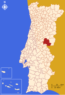
The municipality is bounded in the north by Fundão, in the east by Idanha-a-Nova, in the south by Spain, in the southwest by Vila Velha de Ródão, and in the west by Proença-a-Nova and Oleiros.
- ^ "INE Census 2021: Centro / Beira Baixa / Castelo Branco / Castelo Branco; last updated: November 23, 2022". Retrieved 2022-12-29.
- ^ "INE Census 2021: Centro / Beira Baixa / Castelo Branco / 19 civil parishes; last updated: November 23, 2022". Retrieved 2022-12-29.
- ^ "Áreas das freguesias, concelhos, distritos e país". Archived from the original on 2018-11-05. Retrieved 2018-11-05.


