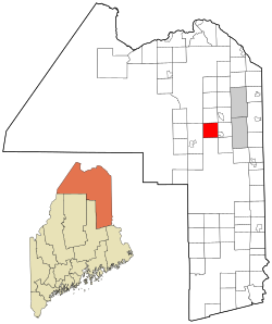
Castle Hill, Maine | |
|---|---|
 Location of Castle Hill, Maine | |
| Coordinates: 46°43′5″N 68°13′14″W / 46.71806°N 68.22056°W | |
| Country | United States |
| State | Maine |
| County | Aroostook |
| Area | |
| • Total | 36.15 sq mi (93.63 km2) |
| • Land | 35.69 sq mi (92.44 km2) |
| • Water | 0.46 sq mi (1.19 km2) |
| Elevation | 869 ft (265 m) |
| Population (2020) | |
| • Total | 373 |
| • Density | 10/sq mi (4.0/km2) |
| Time zone | UTC-5 (Eastern (EST)) |
| • Summer (DST) | UTC-4 (EDT) |
| ZIP code | 04757 |
| Area code | 207 |
| FIPS code | 23-11300 |
| GNIS feature ID | 0582397 |
| Website | mapleton |
Castle Hill is a town in Aroostook County, Maine, United States. The population was 373 people at the 2020 census.[2]
- ^ Cite error: The named reference
Gazetteer fileswas invoked but never defined (see the help page). - ^ "Census - Geography Profile: Castle Hill town, Aroostook County, Maine". Retrieved February 27, 2022.